SQL in GIS: The Emergence of Spatial SQL
This article will explore what spatial SQL is, and we can use it in GIS to store, query, and analyze data including PostGIS, SQLite, etc.

This article will explore what spatial SQL is, and we can use it in GIS to store, query, and analyze data including PostGIS, SQLite, etc.
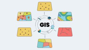
What Is Geographic Information Systems (GIS)? GIS is a technology-based system that captures, stores, analyzes, and visualizes spatial data.
We explore the ways that Big Data is being used in GIS such as real-time data analysis, spatial data mining, location-based services, etc.
We’ll list the top 30 most popular GIS formats and extensions in the industry including raster, vector, LiDAR, satellite, CAD, and more.
Maps have the power to convey information and tell stories. This list of 15 GIS software outlines the best for analysis and visualization.

In GIS, both vector and raster data models have their advantages and disadvantages. Choosing the appropriate data model is crucial.
Geodatabases are a way to store, query, and analyze geographic data in an organized and efficient manner. Learn more how to unlock GIS data.